ASSESSMENT OF FLASH FLOOD HAZARD RATING OF SOME SELECTED FLOODED ROADS IN AWKA.
Keywords:
Assessment, Awka, Flash Flood, Hazard Rating and RoadAbstract
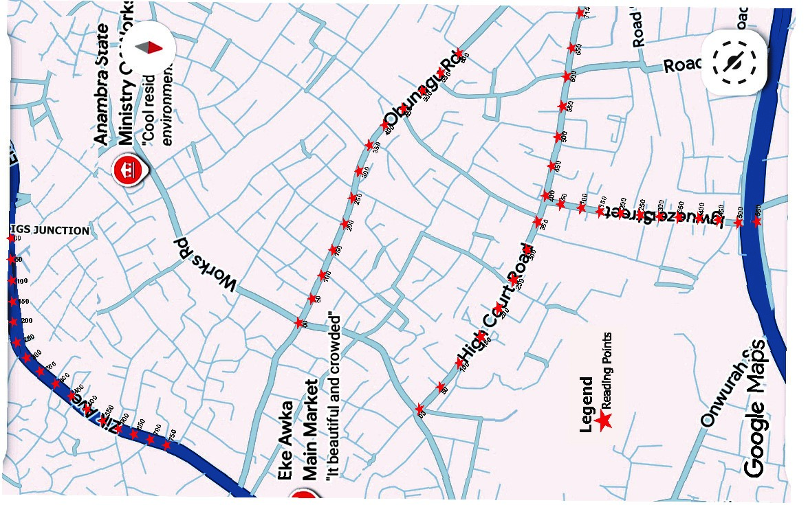
Flood has been a major problem in the study area. Four (4) major flood prone areas were chosen for this study. They are Court Road (R1) on Lat. 6.210 - 6.213 & Lon. 7.066 - 7.060, Obunagu Road (R2) on Lat. 6.213 - 6.215 & Lon. 7.060 -7.058, Eke Awka (R3) on Lat. 6.206 - 6.208 & Lon. 7.064-7.059 and Igweze Street (R4) on Lat. 6.207-6.213 & Lon. 7.069 - 7.072. R1 measured a total length of 714 metres, R2= 550 metres, R3= 600m and R4= 600metres. Each of the roads was visited first for observation and subsequently for measurements. The capacity of the existing drainage was measured and observed. These parameters- flood height (H), and flood velocity, (V) were measured at various sections of the roads at 50 metres interval. The required values were used to calculate the hazard rating (HR) of the roads during floods at various points. The HR ranged from (1.25-2.99) for R1, (1.60-2.58) for R2, (1.39-2.17) for R3 and (1.81-2.31) for R4 which indicates high risk. A total of 56 points were taken. More than 70% of the points showed high risks for all while 28% of them were risky for some as a result of inadequate drainage capacity.