Delineation of Shallow Soil Pipes and Subsidence Zones in Awka South, Anambra Basin, Using Vertical Electrical Sounding and Ground Magnetic Methods
Keywords:
Reconfigurable intelligent surface, covert communication, smart grid, advanced metering infrastructure, smart meters.Abstract
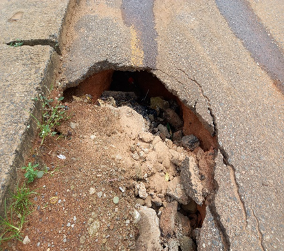
This study employed an integrated geophysical approach using Vertical Electrical Sounding (VES) and ground magnetic surveys to investigate soil pipes in two sinkhole sites in Awka South. The study area lies within the Anambra Basin, underlain by the Imo Shale Formation and dispersive Nanka sands, with soils that are lateritic, acidic and highly erodible. Eighteen VES were acquired using Schlumberger array with AB/2 up to 100 m using PASI resistivity meter and inverted with IPI2Win software. Ground magnetic data were acquired on a 2 m x 2 m grid along 9 profiles using proton precession magnetometer, with diurnal correction and gridding using minimum curvature method. Results show topography strongly controls pipings with Site I characterized by closed depressions (38-58 m elevation) and Site II by an elongated SW-NE crest (>150 m). Magnetic data ranged from -196 to +91 nT in Site I and -374 to +164 nT in Site II. Magnetic highs of +29.5 to +164.0 nT indicate intact ferruginous sandstone and ironstone pipe roofs, while magnetic lows of -124.3 to -374.0 nT delineate leached zones, water-saturated pipes and air-filled voids. VES revealed 3-5 layer resistive-conductive-resistive models with HK, HKH, KHK, AK, AKQ curves. Σρ at <5 m proved diagnostic: very low values of 16.36-66.8 Ωm (VES 7,8,9,13) indicate active pipes, while very high values of 78,549-97,221 Ωm (VES 1,5) indicate non pipes. Piping is shallow at 0.5-3.5 m depth, with roof thickness as low as 0.649 m. Integration confirms pipes form an interconnected SW-NE network controlled by structure and perched aquifer drainage at the Imo Shale/Nanka interface, rendering patching ineffective. The study provides a baseline for engineering remediation.